Make the most of the Great British outdoors this summer with our guide to Britain's best summer walks. From the rolling hills of Cumbria to the rambling moorland on Dartmoor, all of these delightful trails will allow you to discover how stunning Britain's landscape really is. We have included a variety of different walks in varying degrees of difficulty, length, ascent and time.
Length | 7.0 miles / 11.4 km
Ascent | 3140 feet / 952 metres
Time | 6 hours 40 minutes
Grade | Moderate/Hard
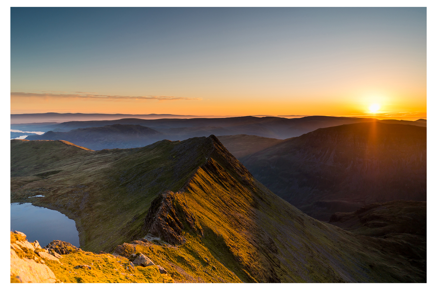
This Lake District walk starts from Swirls and ascends Helvellyn via Browncove Crags. The route continues north over Whiteside and Raise to reach Sticks Pass from where a descent back into the valley is made. This is a great route to the top of England's third-highest mountain with equally stunning views.
Length | 8.5 miles / 13.8 km
Ascent | 900 feet / 273 metres
Time | 5 hours 10 minutes
Grade | Easy/Moderate
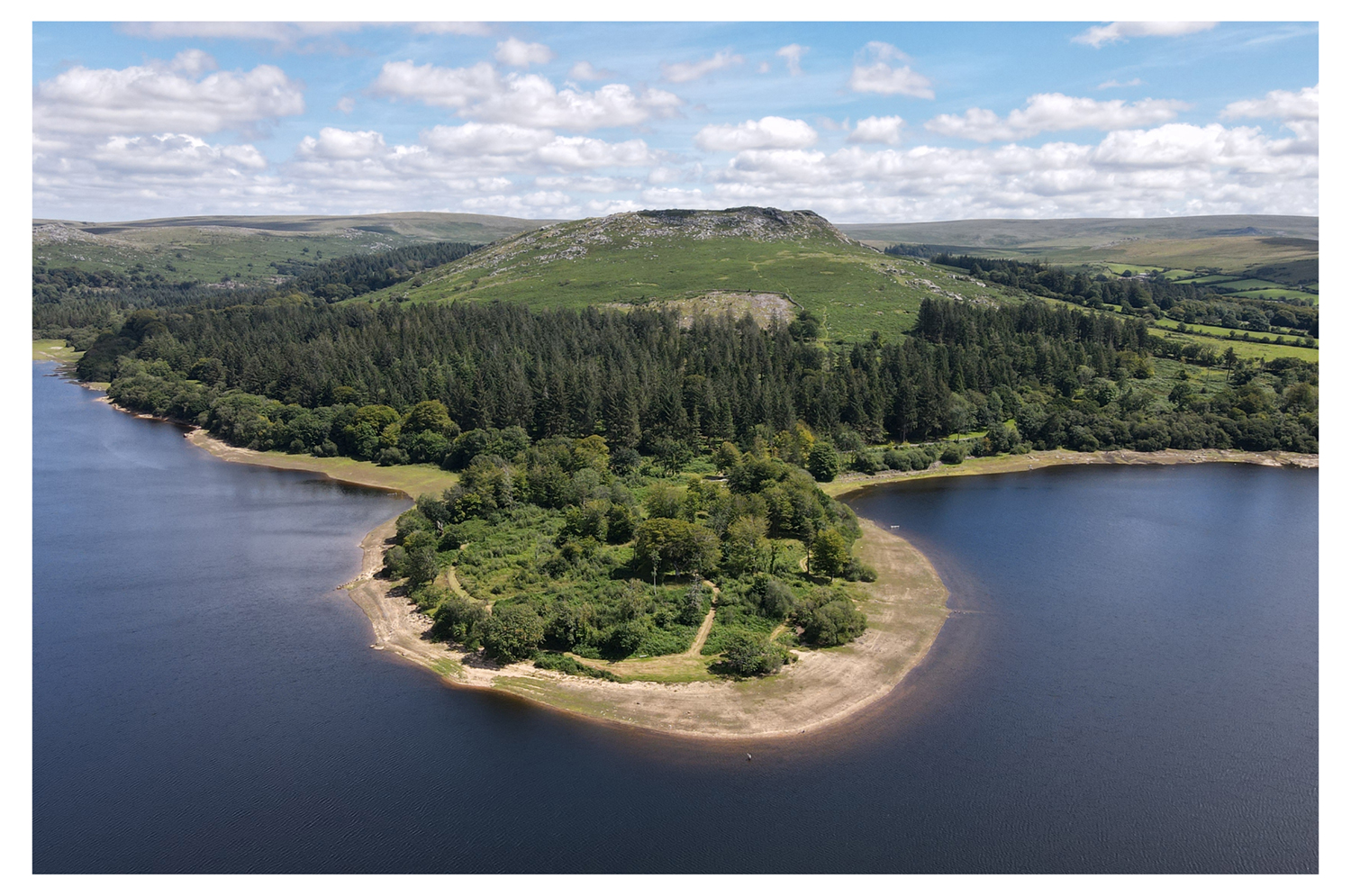
The Devon village of Yelverton is the start and endpoint for this walk that includes a circuit of the Burrator Reservoir. The route includes some typical country lanes of the area and views to some of Dartmoor's Tors.
Length | 8.5 miles / 13.8 km
Ascent | 4340 feet / 1315 metres
Time | 8 hours 40 minutes
Grade | Moderate/Hard
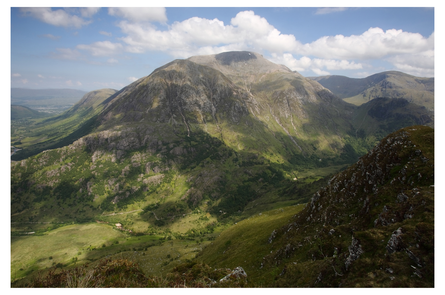
Ben Nevis is the highest summit in the British Isles. It is a popular walk but should not be underestimated as there are navigational difficulties for the unwary. Adequate food and clothing are essential.
Length | 8.5 miles / 13.8 km
Ascent | 450 feet / 136 metres
Time | 4 hours 40 minutes
Grade | Easy/Moderate
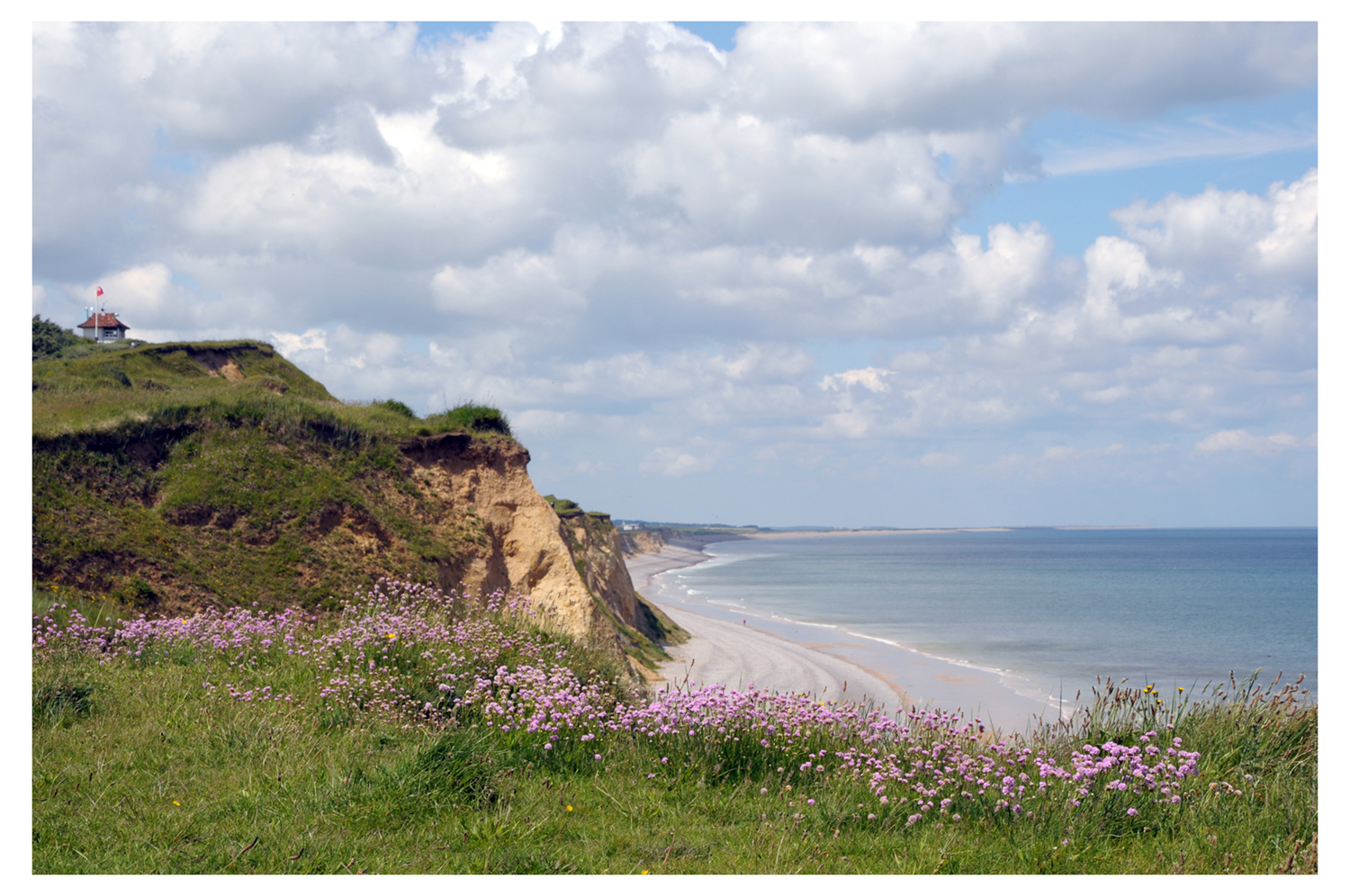
This linear walk follows the Norfolk Coast Path from Sheringham to Cley-next-the-Sea. The walk includes some interesting terrain and offers the chance to see many species of birds.
Length | 9.5 miles / 15.4 km
Ascent | 2000 feet / 606 metres
Time | 6 hours 50 minutes
Grade | Moderate
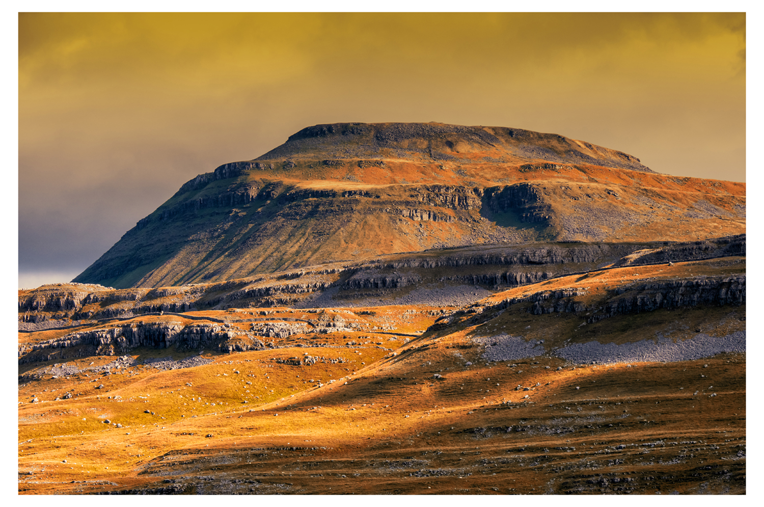
This Yorkshire Dales walk tackles Ingleborough from Chapel-le-dale. The initial stages of the ramble are straightforward, but the ascent of the hill itself is reminiscent of the stairs that Frodo climbed over the mountains in 'Lord of the Rings'. From the summit, the descent is straightforward if irregular underfoot, and the final leg, parallel with the river Doe along the former Roman road, is easy. The views from the summit across the Yorkshire Dales National Park remain, as ever, magnificent.
Length | 11.3 miles / 18.4 km
Ascent | 2400 feet / 727 metres
Time | 8 hours
Grade | Moderate/Hard
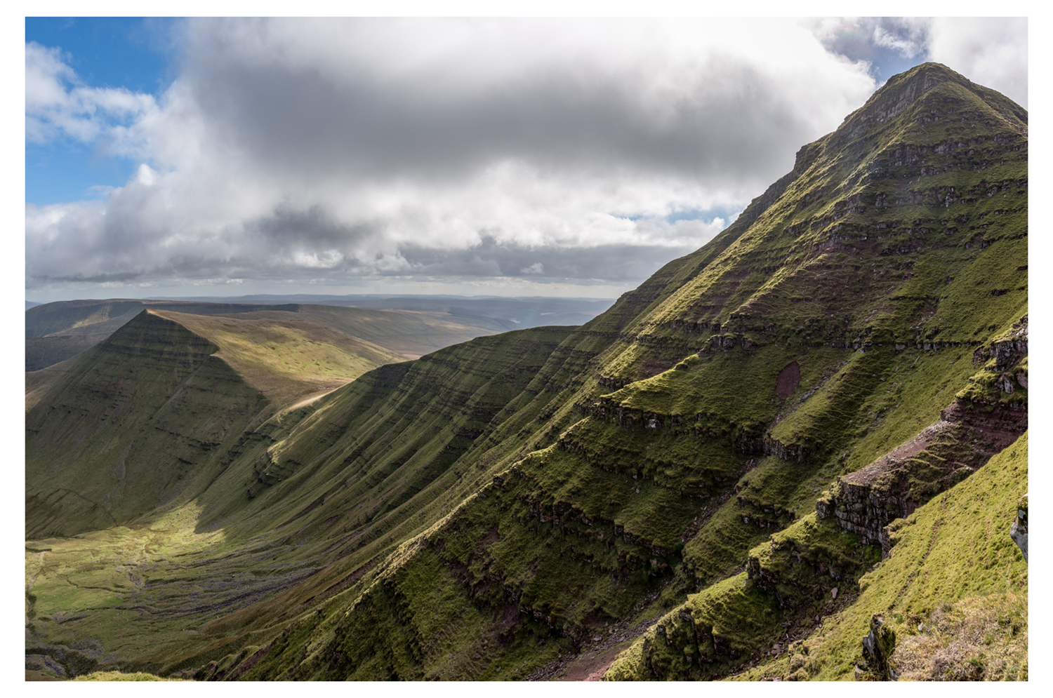
A Brecon Beacons walk starting in Pencelli (near Brecon) that includes the summit of Pen y Bryn, the impressive cairn of Carn Pica, views over Talybont Reservoir, a section of the Taff Trail along the Monmouthshire and Brecon Canal plus much more scenic interest along the way.
Length | 8.0 miles / 13 km
Ascent | 1350 feet / 409 metres
Time | 5 hours 20 minutes
Grade | Moderate
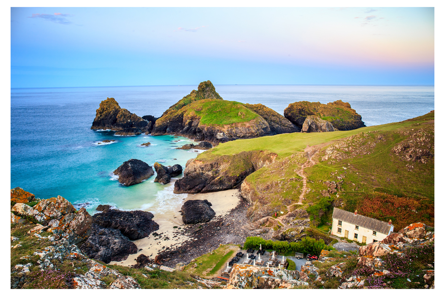
Starting from the Lizard and visiting Kynance Cove and Cadgwith, this Cornwall walk includes some of the finest coastal scenery in England. The Lizard is the most southerly point in England and the route includes a section of the South West Coast Path, some wild moorland, an interesting chapel and many other points of interest.
Length | 6.0 miles / 9.8 km
Ascent | 100 feet / 30 metres
Time | 3 hours 10 minutes
Grade | Easy
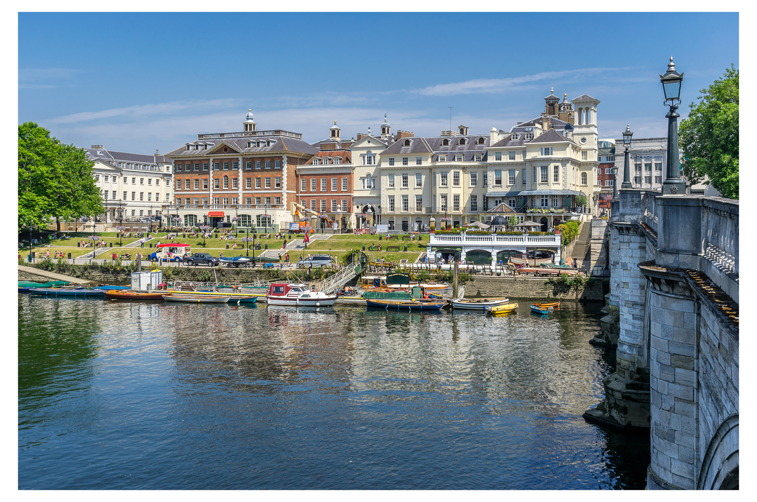
The Thames Path provides easy walking and interesting surroundings. The section from Barnes to Richmond covered by this walk also includes the option to visit Kew Gardens and enjoy the riverside 'attractions' at Richmond.

Length | 5.0 miles / 8.1 km
Ascent | 780 feet / 236 metres
Time | 3 hours 20 minutes
Grade | Easy/Moderate
This walk combines the delights of the Worcestershire village of Broadway with the Broadway Tower perched high on the Cotswold Hills above the village. The views are good and the walking generally relaxed although you do have to climb to reach the Tower. Extensive views are the reward for your efforts.
Length | 9.0 miles / 14.6 km
Ascent | 3300 feet / 1000 metres
Time | 7 hours 50 minutes
Grade | Moderate
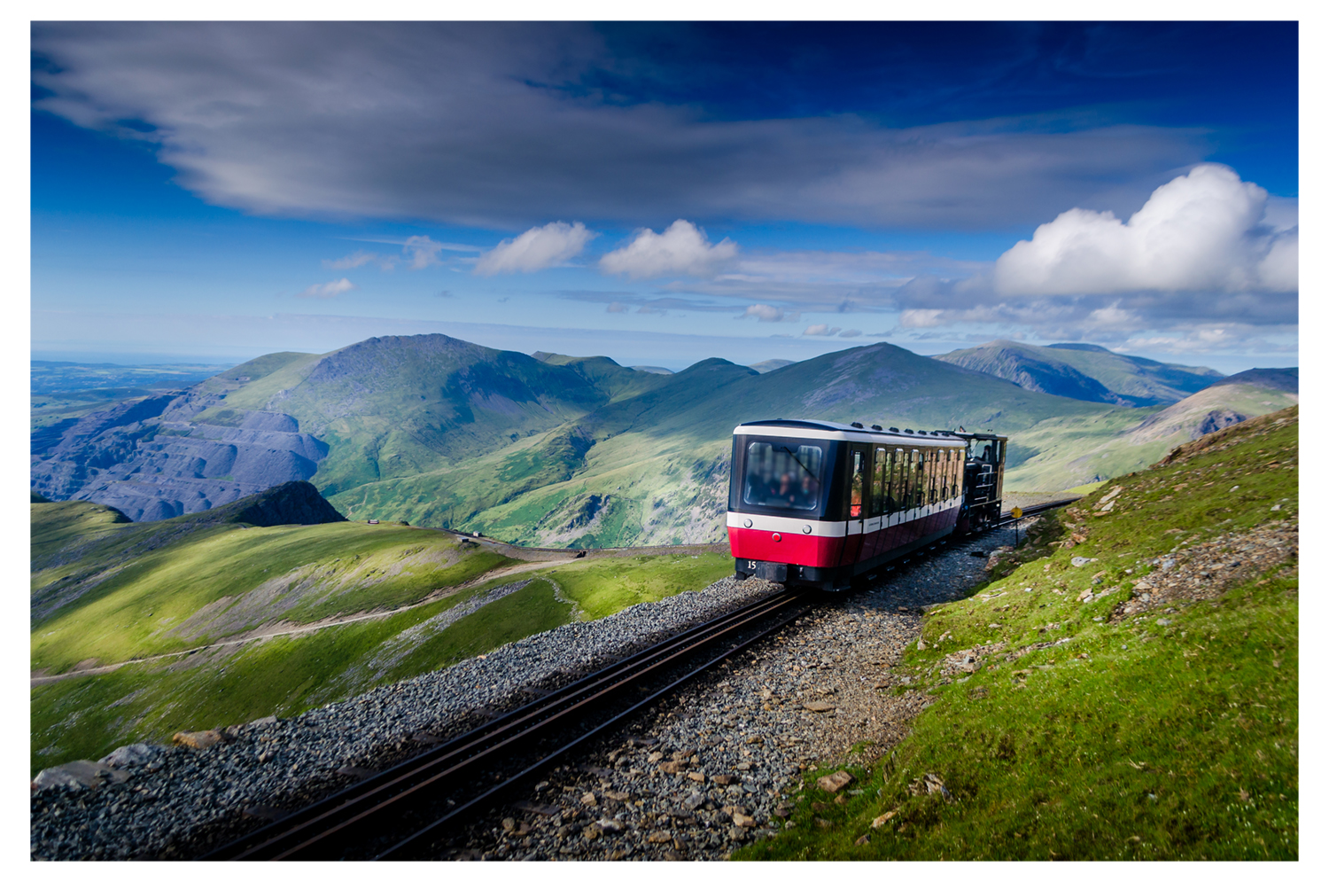
Snowdon, the highest mountain in Wales, is the objective of this walk. This Snowdonia route is probably the easiest way to Snowdon's summit. Starting in Llanberis, it must be remembered this walk is a serious mountain expedition so you should go fully prepared.
We hope you have been inspired to visit some of these stunning spots across the UK. To discover our other interesting blog posts, please click here.


